WalkLakes
Sewingshields Crags
| Area: | The Scottish Border to the River Tyne |
| County: | Northumberland |
| Country: | England |
| Classification: | Tump |
| Height: | |
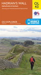
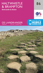
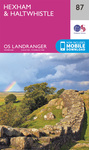
| Maps: | OL43(E) Explorer or 86, 87 Landranger |
| Grid Ref: | NY800700 Hills nearby: 5km 10km 20km |
| Summit: | ground by remnants of wall 10m NNE of trig point |
| Notes: | summit is c 1m higher than flush bracket |
| Daylight: | dawn 07:13, sunrise 07:50, sunset 17:56, dusk 18:33 |
If you've walked up this hill already why not log on or register and record your walk?
3 other walkers registered on our site have already walked up this hill including: Floydian1, Lancylass, and Oli R C.
In our forum you can read the following walk reports which include this hill:
WalkLakes recognises that hill walking, or walking in the mountains, is an activity with a danger of personal injury or death.
Participants in these activities should be aware of and accept these risks and be responsible for their own actions.
Participants in these activities should be aware of and accept these risks and be responsible for their own actions.