Troutbeck Tongue
Troutbeck Tongue nestles between Trout Beck and Hagg Beck splitting the valley of Troutbeck like a wedge as you look to its head of Threshthwaite Mouth. It is of modest height and its position far into the valley makes for an anticipatory walk in. Glimpses can be seen through the trees and hedgerows but it isn't until quite close that its complete profile may be seen. Then you wonder how it can be climbed. A direct ascent can be made of the steep nose of the fell, albeit with a little detour because of a wall blocking the way, and is quite straightforward. It is just steep and in summer the path plays 'peek-a-boo' under waist high bracken. Views from its summit are not expansive being limited by substantially higher surrounding fells, except back down the valley to slightly west of south. Windermere then being the main interest.
Starting on the outskirts of the village of Troutbeck, this walk takes a meandering route, passing the church and near to the popular walkers' hostelry of The Mortal Man, to avoid too much walking alongside the A592. Then linking various paths and quiet roads through pastoral scenery to the base of the Tongue. after a good steep but short climb the summit is gained. Returning along a Roman road, a low-level part of the famous High Street, there are more views into and across the valley. After only a short section along the pavement beside the A592 the car park is just a step or so away.
The church in Troutbeck is unusual for being called Jesus Church as they are usually named after patron saints.
A small informal parking area just 50m (55 yards) down the back road near church bridge is the most appropriate starting point and has space for approximately 6 cars.
The work we do on this web site, both researching and writing up walks, takes a lot of our time but doesn't make us a great deal of money. The main way we fund this work is by selling our walks as PDFs for printing. Please use the "Buy walk in Adobe/PDF format to print or for your phone or tablet" link on the walk page to do that.
If you have already purchased the walk then you if you are logged in you can find it in your rucksack (link top right on any page) in a format suitable for printing.
Thank you for your support
Paul and Beth

Troutbeck Tongue

Down Troutbeck valley to Windermere
This walk takes you to the top of the following hills: Troutbeck Tongue; and includes 1 Wainwright and 1 Birkett.
- Maps:
 50K: 90
25K: OL7
50K: 90
25K: OL7
- Start:
- NY411026 (get directions via Google Maps)
- Near to:
- Ambleside, Glenridding/Patterdale, Penrith, Ullswater
- Tags:
- Birketts, Wainwrights
- Distance:
- 12.5km (7.7 miles)
- Ascent:
- 369m
- Min. time:
- 3 hrs 7 mins
- View in 3-D:
-

- Terrain:
- 3 - very rough/boulder scree
- Bog Factor:
- 2 - soft
- Tech Diff:
- 2 - basic map reading
Most of the paths and tracks are grass or rough stone but one short section near the end of the walk is very rough and loose although the gradient is not especially steep. - Dog issues:
- You may encounter cattle.
Includes stiles or other dog obstacles.
Little available water until reaching the crossing of Hagg Gill late in the walk.
Purchases: Buy walk in Adobe/PDF format to print or for your phone or tablet
 Buy route for your GPS


Walk height profile
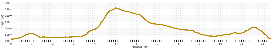
note that gradients are usually grossly exaggerated
Route Description
From the parking area return to the main A592 and turn left along the pavement to the church. Continue to the far edge of the church grounds and turn left signposted "public bridleway". Bear left on to the gravel track around the edge of the field. In about 100m (110 yards) - at the end of the gravel, bear slightly right to pass through a gate almost directly ahead with a small public footpath sign.
Follow the path alongside the fence to the middle of the field and where the fence turns right go straight ahead across the field. The clearly used path ducks under a large oak tree and continues ahead to a kissing gate. Pass through, and along a terraced path above a beck to go through another kissing gate. Into the fenced pedestrian lane between fields, and along to yet another gate. Passing through this gate continue to the tarmac road. Turn right to the A591 again.

Jesus Church, Troutbeck

Bear slightly right through the gate

The Mortal Man, Troutbeck
Carefully cross the road and take the narrow lane directly opposite. This is Truss Lane. Follow it down to join Ing Lane below Town Head. Reaching the tarmaced Ing Lane, bear right. Follow the tarmac, bear right to cross the humpbacked Ing Bridge and then left. Eventually you cross Hagg Bridge .
.
The other side of Hagg Bridge is an unfenced grass field, and a stile whose only remaining purpose is to hold up the footpath sign! Follow the direction of the sign to cross the field, the path follows only just to the right of a small hummock, called Hall Hill, in the middle of the field and climbs to a gate in the wall. Go through this gate and out onto the track.

A glimpse of Troutbeck Tongue from Truss Lane

Hall Hill and the Troutbeck Valley
Turn right to follow the track as it swings around the right hand side of Troutbeck Tongue. This easy track drops slightly to a gate. Pass through the gate and immediately leave the track for a narrow path climbing steeply on the left. This zigzags a little through luxurious summer bracken and returns to follow the wall for a few metres before bearing away to the right.
Continue climbing to the ridge line where the views now open out quite dramatically. Having gained the ridge bear right to cross a step stile - a bit of fence lifts to allow dogs underneath. Follow the path climbing all the time with a little less slippery grass and bracken, and a little more rock.
There are no difficulties on the ridge despite appearances that might deceive. When the gradient eases it is not far to the pointed summit cairn.

Faint path up Troutbeck Tongue

Herdwick ewes on Troutbeck Tongue

Troutbeck valley from Troutbeck Tongue

Troutbeck Tongue Summit Cairn
Continue over the summit area following the grass path. As you descend there are occasional boggy patches. The ridge widens with the path keeping mostly to the right. Drop down to the step stile at the fence corner. A section of fence lifts to allow dogs underneath - replace carefully afterwards.
Continue on, the path becomes a track which you can see in the distance joining to the bridleway in the valley. However well before that, hidden by the undulations and the bracken, the track swings right to join an ATV track coming up from the valley. Bear right again onto the track and descend easily to valley floor. Reaching the track at the bottom, which is part of the old Roman road of High Street, bear right.

Windermere from Troutbeck Tongue

Along Troutbeck Tongue to Threshthwaite Mouth

Track down Troutbeck Tongue to High Street
Pass through one gate on the bridleway and just before a second gate above a prominent barn, bear left to go through a gate. There is a small bridleway arrow on the gatepost. Drop down to cross Hagg Gill via the footbridge and bear right to pass immediately below the quarry on the fell side.
The path continues and soon becomes a track. Stay on the track above the pasture walls.

High Street alongside Hagg Gill

Approaching the Hagg Gill crossing and barn

Troutbeck Park Farm, Red Screes above
Eventually reaching Long Green Head Farm, bear right through the gate above the buildings. Continue again along the track.
Tall deer fencing encloses parts of the fell above the track, pass through the gates and secure them behind you. Just after one such gate the track splits just above the lodges of Limefitt Holiday Park mostly hidden below. Take the left branch to climb gradually, staying above Limefitt.
Pass through an ordinary gate and meeting the bridleway just above, bear right. Reaching a junction of paths, bear right to continue the descent. The track deteriorates becoming very rough and loose underfoot. Follow the track as it swings sharply right and descends beside The Howe. Continue on the track down to the road once again. Cross to the pavement on the other side and turn right to cross the wooden footbridge just next to the road bridge. The parking area is just down the lane on the left.

Long Green Head Farm and Troutbeck Tongue

Looking across Troutbeck to The Mortal Man

If you like this walk then why not try one of our other nearby walks:
| Name | Rating | Starts |
|---|---|---|
| Sour Howes and Sallows | 10m (11 yards) away | |
| Lily Tarn above Ambleside | 3.9km (2.4 miles) away | |
| Wansfell Pike, Troutbeck, and Skelghyll Wood | 3.9km (2.4 miles) away | |
| Red Screes and Middle Dodd from Ambleside | 4.0km (2.5 miles) away | |
| Orrest Head - the view that changed a young man's life | 4.0km (2.5 miles) away | |
| High Sweden Bridge Circular | 4.0km (2.5 miles) away | |
| Stockghyll Force - Ambleside | 4.0km (2.5 miles) away | |
| Wansfell, and Wansfell Pike | 4.0km (2.5 miles) away | |
| Loughrigg Fell from Ambleside | 4.0km (2.5 miles) away | |
| Loughrigg Tarn | 4.0km (2.5 miles) away | |
| An Ambleside Waterfalls Wander - Stockghyll Force and Blue Hill Wood | 4.0km (2.5 miles) away | |
| The Fairfield Horseshoe | 4.1km (2.5 miles) away | |
| The Kentmere Horseshoe | 4.6km (2.9 miles) away |
Unless otherwise stated the text in this walk is the copyright of Hug Solutions Ltd trading as The Hug and the photographs are the copyright of Elizabeth Oldham. Hill data is derived from Database of British and Irish hills which is licensed under a Creative Commons Attribution 3.0 Unported License. Maps contains Ordnance Survey data © Crown copyright and database right 2011 and paths © OpenStreetMap Contributors,CC-BY-SA, 2011